Seal of Dane County County of Dane
Translate
Dane County Parks

Running

The Dane County Park System has hundreds of miles of trails ranging from paved, hard surfaces to rustic trails through the woods. Below are some ideas of routes to get you started but there are endless opportunities within our parks. Some, but not all, parks may have restrooms or drinking fountains that are available seasonally. It is best to always bring water with you to a park, just to be safe.

After you've explored our suggestions below, check out other parks properties within our park system.


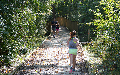
Hard surface trails might include paved trails, crushed stone trails, and wooden boardwalks. Below are some popular routes however each park has additional routes and trails to explore!

CamRock County Park 

  • Length: 1 mile - out and back
  • Description: CamRock County Park features a number of mountain bike trails popular with technical runners but it also has a very flat crushed stone trail that travels the length of the park. The total length of the trail is 2.4 miles so this route could easily be extended. If you are there with kids, make sure to check out the natural playground at Shelter #2.
  • Map: Route Map (Garmin Connect)
  • Starting Location: parking lot at Shelter #1 - 68 County Highway B, Cambridge
  • Restrooms: Portable toilet available year round at Shelter #3.

Pheasant Branch Conservancy

  • Length: 3.2 miles - loop
  • Description: Pheasant Branch Conservancy features a crushed limestone trail with boardwalks in a few locations. Passes through prairies, woodlands and by a natural spring. Can be muddy during the spring thaw or after it rains.
  • Map: Route Map (Garmin Connect)
  • Starting Location: parking lot at 4864 Pheasant Branch Rd, Middleton
  • Restrooms: City park shelter restroom and portable toilet may be available.

Lower Yahara River Trail

  • Length: 5.41 miles - out and back
  • Description: The Lower Yahara River Trail is a paved, multi-use trail that includes a mile-long boardwalk bridge over Lake Waubesa. Connects to the Capital City State Trail. No hills. 
  • Map: Route Map (Garmin Connect)
  • Starting Location: Capital City Trail/Lower Yahara River Trail trailhead parking lot at 3102 Lake Farm Road,Madison. For a much shorter run, consider parking at William G. Lunney Lake Farm County Park to be closer to the boardwalk bridge
  • Restrooms: Toilets available seasonally at WG Lunney Lake Farm County Park and McDaniel Park.

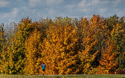
Natural surface trails include wide or narrow natural surface trails that might have roots, rocks or other hazards to watch for.  Below are some popular routes however many parks have additional routes and trails to explore!

Jenni & Kyle Preserve 

  • Length: 0.74 miles - loop
  • Description: The Jenni & Kyle Preserve is a unique park that is intended to serve children and persons with disabilities. Part of this loop run travels on a paved, shared-use trail that pass by two spring-fed ponds. The majority of the loop travels along a natural surface trail through wetland vegetation.
  • Map: Route Map (Garmin Connect)
  • Starting Location: main parking lot and shelter at 925 Post Rd., Madison
  • Restrooms: restrooms at shelter may be available seasonally.

Springfield Hill Natural Resource Area 

  • Length: 1.57 miles - loop
  • Description: Springfield Hill Natural Resource Area features wooded valleys, glacial kettle ponds, and open meadow areas. This route travels along the portion of the Ice Age Trail that passes through this park property. Many sections of the trail are single track hiking trails. 
  • Map: Route Map ( Garmin Connect)
  • Starting Location: small, gravel parking lot at 8193 Ballweg Rd, Dane
  • Restrooms: none.

Donald County Park

  • Length: 3.1 miles - loop
  • Description: Donald County Park has a number of trails that pass through prairies, oak woods, intriguing rock outcroppings with scenic vistas and natural springs. 
  • Map: Route Map (Garmin Connect) 
  • Starting location: parking lot at 1898 Sutter Dr, Mt Horeb.
  • Restrooms: vault/pit toilet available seasonally near shelter.

Silverwood County Park

  • Length: 3.21 miles - loop
  • Description: Silverwood County Park has a number of trails that pass through prairies, woods, and farm fields. This route travels mostly along the farm fields at the park and passes by some of the wooded area. 
  • Map: Route Map (Garmin Connect) 
  • Starting location: parking lot at 771 Silver Lane, Edgerton.
  • Restrooms: portable toilet available year round near the parking area.

Indian Lake County Park

  • Length: 3.74 miles - loop
  • Description: Indian Lake County Park is the largest park in the park system with a number of trails that pass through prairies and wood. This route passes through an unfenced dog park on the west side of the lake. Note that running is not allowed on designated cross-country ski trails when snow is present even if they have not yet been groomed. 
  • Map: Route Map (Garmin Connect)
  • Starting location: parking lot at 8183 State Highway 19, Cross Plains.
  • Restrooms: vault/pit toilet available seasonally near parking lot. Portable toilet available year round near dog park entrance.

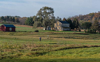
Technical trails refer to hiking trails that contain hills or obstacles such as roots, rocks, stream crossings, etc.  The following parks have trails that appeal to technical runners. They all offer a number of wide and single track paths and have lots of area to explore.